
This is a linear walk along the scenic River Stort from Bishop’s Stortford to Harlow and returning by bus. The total distance is about 7.5 miles but one can break off the walk at several points to catch the bus back because the bus route along the A1184 is never very far to the west of the river. The 501 bus service between Harlow and Stansted Airport runs every 20 minutes on weekdays and hourly on Sundays. It conveniently stops at Harlow Mill and in Rye Street near the start of the walk and at many points in between through Sawbridgeworth, Spellbrook and Bishop’s Stortford town centre. One can work out many variations to this walk using different start and finish points, and the railway gives another option for return journeys. Because the route follows the riverside path for the whole way we do not consider it necessary to provide a route map.
Start: Grange Paddocks Car Park by the swimming pool off Rye Street about half a mile north of Bishop’s Stortford Town Centre OS map ref: TL488 222. Click HERE for a map of the start.
There are other car parks off Pig Lane by Twyford Lock and at Pishiobury Park on the A1184 south of Sawbridgeworth.
Distance: Up to 7.5 miles
Surface: Good level paths; can be sticky during wet periods.
Obstructions: 4 main roads to cross.
Comfort stops: Pubs not far from the route. Coffee shop at Sawbridgeworth Maltings.
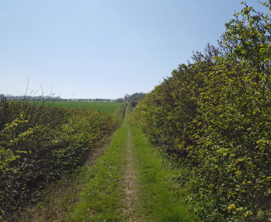
From the bridge to the car park at Grange Paddocks take the path to the south downstream along the bank of the River Stort. You can follow this path all the way to Harlow Mill or as far as you wish. We will call the bank on this side of the river the left bank.

Weir near the old ford
After 200 yards you come to a weir and near this spot is the site of the prehistoric ford which gave its name to the town of Stortford. Stane Street, the Roman road from Colchester to St. Albans, passed through here. The gravel bed of the river is obvious. Soon the river flows round the Castle Gardens with the old Waytemore Castle mound in the centre. At one time this castle belonged to the Bishops of London, hence Bishop’s Stortford.

The old crane
At the first road bridge cross the dual carriageway to the newly surfaced path on the other side. You are now on the towpath at the head of the Stort Navigation which was completed in 1769 making the river navigable for barges to the River Lea and the Thames. For over 150 years cargoes of malt and grain were shipped down to London and coal, slates and timber came upstream. The Stortford and Sawbridgeworth riverside area were filled with maltings, granaries, coal yards and timber yards. On the opposite bank stands an old crane which used to unload timber from the barges and is one of the few remaining vestiges of that era. From here onwards all bridges and side bridges will have numbers in descending order.

Southmill lock
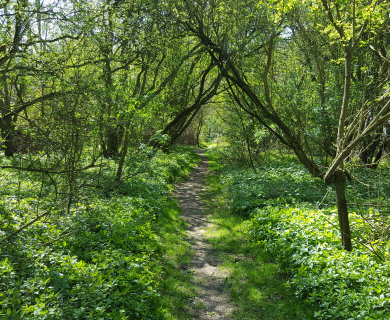
Follow the river through the town, cross over London Road and on to the right bank, continue under the railway bridge and over the weir to reach Southmill Lock. This is the first of 8 locks along the route and you will be likely to see narrow boats navigating one or two of them. Cross footbridge 49 to the left bank. Shortly you will pass the entrance to Rushey Mead Nature Reserve and a bit further on round the bend the wood on the left will have a good display of bluebells towards the end of April.
2 miles from the start is Twyford Lock. There is a car park just along Pig Lane to the right for those who want to start the walk from here. 200 yards below the lock is the Roly Croake, footbridge 47, which used to be a wobbly timber construction but id now solid concrete and steel. The footpath bearing left from the other side of this bridge leads to the Coach and Horses and a bus stop if you should be in need of either one.
Half a mile further downstream at bridge 44 the footpath to the right leads through Thorley Wash Nature Reserve and again to the main road.

A quiet backwater at Spellbrook
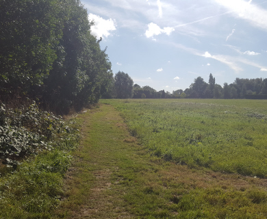
Carrying on along the towpath you pass Wallbury Dells on the left, an ancient earthworks and settlement, before reaching Spellbrook Lock at the 3 mile point. The Three Horseshoes and a bus stop are a short distance off to the right. Keep going along the towpath to Tednambury Lock with Hallingbury Mill over the fields on the left. Another one and a half miles past Tednambury brings you to Sawbridgeworth Lock with its adjacent lockside cottages converted from the old Burton’s Mill buildings.
Now you come to bridge 35 near Sawbridgeworth Railway Station. There is a coffee shop in the antiques centre in the nearby maltings. Carrying on downstream on the right bank you come to Sheering Mill Lock. Notice the initials G D and the hand emblem over the Lock Cottage doorway. George Duckett was the builder of the Stort Navigation.

Harlow Mill Lock
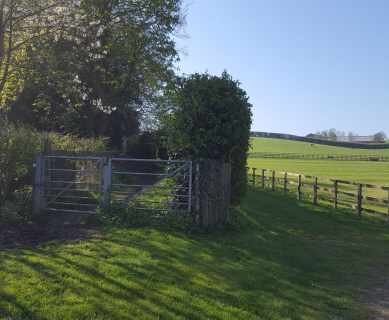
A few hundred yards further on tree enthusiasts will be impressed by the massive trunk of a poplar towering up through trees and bushes on the right. Soon after you will see a wooden walkway across marshy ground which would lead into Pishiobury Park where there is a car park and bus stop up on the main road. Meanwhile you can continue to footbridge 28 where you cross to the left bank and soon reach Feakes Lock set in open countryside. After that the river winds through ancient water meadows and Harlow Marshes to arrive at the bridge just before Harlow Mill Lock and the Beefeater Pub. The bus stop for the return trip is a few yards up the road to the left. The 510 bus runs approximately every 20 minutes but times vary a little though the day. Click HERE for a timetable.

Hi
Is this footpath suitable for cycling along?
Hi James
This is in answer to your comment,from a member.
When the British Waterways Board were in charge of canals and towpaths etc. cyclists were supposed to apply for a permit to cycle along towpaths. I think this permit was free. When British Waterways became the Canal & River trust a year or two back I believe the permit scheme was scrapped and cyclists are encouraged to use the towpaths in a responsible manner except where they have introduced a no cycling zone, but they do not have a statutory right to cycle on them in the same way as pedestrians have where a public footpath follows the towpath, as is the case along the Stort.
Whether the path is suitable for cyclists depends on the cyclist, the type of bike and the time of year. Some parts can get rather muddy on this walk in the winter. Whenever I have used the path in recent times I have always encountered the occasional cyclist. I got the impression that it is used as a route to work for some people in the summer, including some of our Polish community, and generally everyone is courteous and civilised when passing. There is no reason why keen sports cyclists should not use the path provided that they do not ride aggressively when meeting walkers. I have cycled along the river ever since I had my first bike about 70 years ago and it has never been a problem. These days I usually stop when meeting pedestrians until they pass.
Thank you
Brian
Hi Brian
Thank you for your informative response.
Regards
James
I walk regularly along this route. One problem I have found is that a number of cyclists using the towpath have become more agrresive thinking they have some right, simply by being on a bike, to demand walkers give way to them. Also few have bells to let walkers know they are coming. Case of the few spoiling it for the many.
So come on cyclists, you don’t have right of way and if you want walkers to stand aside let them know you are coming
Hi John,
The towpaths are under the custodianship of the Canal & River Trust (CRT) who actively welcome walkers and cyclists. Unfortunately, as you point out there are a few who disregard the etiquette of sharing what can be quite a confined space. The problem has certainly got worse since lockdown with a lot more people taking to the towpaths. I don’t have a solution although I think that you should raise your concerns with the CRT who I understand have received a lot of correspondence on this issue.
https://canalrivertrust.org.uk/contact-us/ways-to-contact-us