
Hybrid Planning application comprising:
(i) A full application for 142 dwellings (class C3) including affordable homes, plus associated accesses, landscaping, open space and infrastructure works (development zone A) , and a north/south primary route; and
(ii) An outline application, with all matters reserved except access, for approximately 608 (Class C3) including affordable homes, a care home (Class C2) , up to 4 hectares of employment land (classes B1, B2, B8 sui Generis (car showroom)), a local centre including up to 1000 sq m for retail (Class A1), and up to 2200 sq m for other uses (Classes A2, A3, A4, A5 and D1), a primary school (Class D1) up to 3 forms of entry and including early years facilities, a secondary school (Class D1) up to 8 forms of entry, open space including equipped areas for play, sustainable drainage systems, landscaping and all associated infrastructure and development.
The BSDFA has formally responded to a Planning Application to develop former Green Belt land to the south of Bishop’s Stortford.
A copy of our full response is below for information.
This is a highly controversial application that has generated a huge response from local residents with over 900 already formally objecting to the plans.
Although the closing date set for making comments / objections was 22nd November I have been advised that the District Council will still accept submissions after this date.
If you haven’t submitted your comments yet but would like to do so a link to the East Herts District Council Planning portal follows.
Ms Jenny Pierce Dave Webber
Planning 14 Grosvenor Close
East Herts District Council Bishop’s Stortford
Wallfields Herts
Pegs Lane CM23 4JP
Hertford
Herts 21st November 2018
SG13 8EQ
Dear Ms Pierce,
3/18/2253/OUT | Hybrid Planning application: Land At Bishops Stortford South Off Whittington Way Bishops Stortford Hertfordshire
I am writing on behalf of the Bishop’s Stortford & District Footpaths Association (BSDFA) with regard to the “hybrid” Planning Application for land at Bishop’s Stortford South. By way of background, BSDFA, a registered charity, was founded in 1957 to preserve, protect and maintain the public Rights of Way network and rural verges in the Hertfordshire and Essex border area around Bishop’s Stortford.
We object to the Planning Application on the grounds that we consider that the development of this site does not meet the “very special circumstances” that were set out following the 2011/2012 planning appeal. It will inflict significant harm to the local environment and is not viewed as sustainable as its location at the southern fringe of the town will increase traffic congestion and pollution. The Bishop’s Stortford Neighbourhood Plan for All Saints, Central’ South and Part of Thorley stated that any decision by the District Council to amend the Green Belt boundaries and develop the site would be “controversial” and “unpopular with the majority of the town’s residents”. This certainly remains the case as evidenced by the significant number of resident objections submitted in relation to this Planning Application.
However, we will confine our comments to the impact on the local rights of way network and the sustainability of the plans for promoting cycling and walking in preference to car use.
“Hybrid” Planning
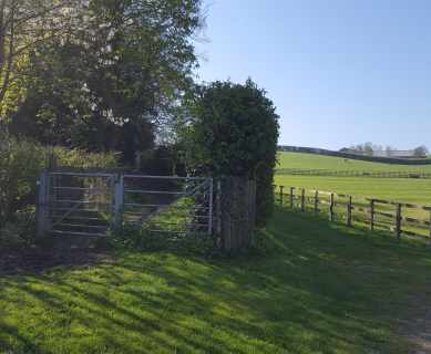
We are concerned that we are being presented with firm proposals for only two sections of the site – residential housing between Whittington Way and the line of the ‘Hertfordshire Way’’ public footpath and a new ‘primary route’ from Whittington Way to St James Way. Our view is that this piecemeal approach is problematic as any future development proposals for the remaining phases could be subject to change as a consequence of poor planning decisions made during the initial development phase.
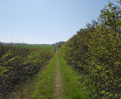
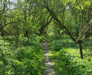
We welcome that the Design & Access Statement (DAS) has highlighted the importance of protecting “unobstructed long-distance” views along the Stort Valley to the southeast from the ‘Hertfordshire Way’ public right of way. However, we are concerned that any future school development to the south of the footpath could involve the erection of security fencing. Given that the school development will be subject to a future application we would expect it to adhere to Policy BSS5 that states that a “minimum (path) width of 3 metres should be provided” and that “any fencing must be low visual impact, built structures should not obstruct the views and open space, and a 10 metre wildlife corridor either side of the right of way should be maintained (unless demonstrated that other appropriate measures would be more effective in protecting and enhancing biodiversity)”.
Connectivity for pedestrians and cyclists
We note that the outline plans for the site incorporates a network of paths for the pedestrians and cyclists but we find the proposals for residents connecting to key Bishop’s Stortford destinations (town centre, railway station and the main employment areas) unconvincing and unsustainable.
- The DAS states that the site is “within a convenient walking distance of local facilities at the Thorley Neighbourhood Centre” which contradicts BSS3 that states that the site is “detached from the nearest community facilities” and “more than the Department of Transport’s guidelines for reasonable walking distances”.
- The DAS states that it is “creating legible and safe connections” for cycling and that a “number of cycle routes link the site to the town centre”. Really? I’ve been cycling around Bishop’s Stortford from Thorley Park for almost 30 years and I’ve yet to come across this network.
- The DAS statement that the site is “highly accessible by sustainable forms of transport” is misleading and requires substance. The DAS (4.3 Access & Movement Strategy) refers to a “route awareness strategy” that will encourage cyclists and pedestrians to “use the quieter routes between the development and the centre of Bishop’s Stortford”. Is this document available for review?
- The site will be encircled by four busy highways yet there is no mention of safe crossing provision for all points where pedestrians (and or cyclists) leave the site. We would expect to see safe crossing provided at the following points:
- “Hertfordshire Way” (Thorley FP004) – London Road crossing. This public footpath would see a significant increase in footfall given that this is the most direct pedestrian route to the River Stort. London Road is extremely busy and the provision of a Puffin or Pelican crossing is essential. It should be noted that the public footpath to the river involves negotiating two pedestrian bridges (one steep and the other very narrow) which are not suitable for pushchairs or the frail. The nearest river access for those with pushchairs (and cyclists) is via Pig Lane (a very narrow and busy rat run that offers no pathway).
- “Hertfordshire Way” (Bishop’s Stortford FP034) – Obrey Way crossing. This public footpath provides pedestrians with access to Thorley Park facilities and an alternate route through to the Southern Country Park (albeit along Thorley Lane which is narrow and has no footway provision). Obrey Way is a busy road and the current pedestrian refuge island should be replaced by a Puffin or Pelican crossing.
- Thorley FP001 – This public footpath crosses Obrey Way close to its junction with St James Way and would be the main route for pedestrians entering or leaving the Southern Country Park. A Puffin or Pelican crossing here would be essential.
- Thorley FP001 – At its eastern end this footpath meets London Road approximately 100 metres from the Coach and Horses public house and restaurant. This is the nearest public house to the site and so it would not be unreasonable to expect to see a significant increase in pedestrians crossing at this point. The provision of a Puffin or Pelican crossing would be essential.
- Thorley FP003 – This public footpath crosses St James Way just east of the Obrey Way roundabout. The crossing is located at a very dangerous location and isn’t heavily used at present but this is likely to change if residential development goes ahead as it provides a direct link to Thorley Church and the open countryside to the south of Thorley village.
The DAS “Access & Movement Strategy” refers to foot and cycle links along the existing public rights of way” across the site. Please note that these “rights of way” are public footpaths not bridleways and as such are for pedestrian use only
We note that a pedestrian and cycle path is proposed to run alongside the south side of Whittington Way as a connection to and from the site to Thorley Park. The plans indicate that the path will be crossed by several estate access roads leading onto Whittington Way which apart from the danger this will lead to traffic travelling to and from Thorley Park will create an additional hazard for pedestrians and cyclists. What measures are proposed to create a safe environment for users of this mixed use path?
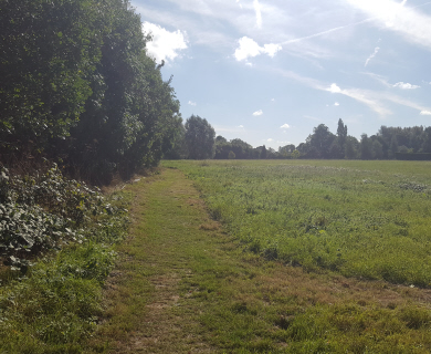
Green spaces
The green spaces in Bishop’s Stortford South should be considered to be an extension of the Southern Country Park rather than a local amenity for the new residents – if development goes ahead then the emphasis should be on creating a unified open space extending from Thorley Street through to Hadham Road. The Bishop’s Stortford South green space should be considered to be equally accessible to the residents of Thorley Park and St Michaels Mead.
These comments do not imply approval for this proposed development and we reserve the right to submit further comments in the future.
Yours sincerely,
Dave Webber
Chair – Bishop’s Stortford & District Footpaths Association

I am leading a circular walk from Bishops Stortford and got as far as Thorley and was unable to connect with the Hertfordshire Way due to road works and road closures. Could you please let me know how I would get from Thorley Hall back to BS along the canal path.
With many thanks