We were recently made aware that a GI&BMP had been drafted for the new Stortford Fields development to the north west of Bishop’s Stortford. Its purpose is to set out shared (Council/developer) expectations regarding the stewardship of the green infrastructure at the 2,200 new home development. The s.106 agreement (see note below) between East Herts District Council and the developers requires that whatever body is established or contracted to undertake the stewardship of the community assets must take the GI&BMP into account. The plan proposes establishing bespoke maintenance regimes for the many different and bio-diverse community assets, including the woodland and wetland. The GI&BMP also requires the programme of work to include improvement to the biodiversity of the land.
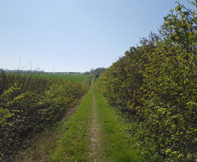
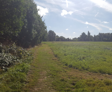
The Association’s particular interest is in the existing public rights of way that cross Stortford Fields together with proposals to create a network of new footpaths and cycleways. Our understanding is that many of the new paths will not be adopted by the Highway Authority and as a consequence would need to be maintained by a community assets management body.
Full details of the planning application (including the GI&BMP) can be found on the East Herts District Council website – please here
The Association together with East Herts Ramblers has reviewed the application and have provided the following comments:
1. Page 2. “Providing green infrastructure also emphasises the importance of connecting the many individual spaces to enhance a local area.”
Where is the connection between Stortford Fields and the outlying footpaths and other green spaces within Bishop’s Stortford documented?
2. Page 13 states that new Greenways will be designed “as multipurpose routes for walking, cycling and horse riding.”
Can you explain what steps will be made to ensure that the new ‘shared use’ paths are designed to provide safe passage for pedestrians, cyclists and horse riders? Has the GIBMP taken into account the following key documents: (i) Department for Transport (September 2012) Local Transport Note 1/12: Shared use routes for pedestrians and cyclists and (ii) Sustrans (2014) Design Manual Chapter 5: Traffic Free Routes: Conceptual design (draft) route types, alignment and general principles?
Can you also confirm whether there are any plans to seek to convert the two existing public footpaths (BS001 and BS002) into public bridleways?
Our understanding is that all three existing public rights of way paths will be crossed by the primary estate road and bus route. Traffic (or any other obstruction) does not have the right to interfere with the publics’ right to use these paths. The plan is not clear what measures will be in place to ensure continued safe and unimpeded use of the existing PROW.
3. Page 18 states the plan “…has been written in consultation with:” ……
The list does not include one representative from a walking or cycling group. Why is this?
A key part of the green infrastructure are the Public Rights of Way and proposed ‘greenways’, which are the enablers / interface for the public to visit the various green areas within the development. I am sure the various trusts (e.g. Amphibian and Reptile, Wildlife, Bat) can contribute greatly within their field of expertise, but I am sure that does not include pedestrian and cycle ways.
4. Page 19, fig 5. The key states “Existing & Proposed Public Rights of Way”, however the yellow colour chosen makes it impossible to see on the figure. Particularly as it is the same colour as apparent paths alongside estate roads.
Do they mean “Existing & Proposed Public Rights of Way” or “Existing Public Rights of Way & Proposed estate paths”?
5. NPPF para 75. “Planning policies should protect and enhance public rights of way and access. Local authorities should seek opportunities to provide better facilities for users, for example by adding links to existing rights of way networks including National Trails.”
The text in bold is an important part of the NPPF and can be applied to the Stortford Fields development. It is appreciated that not all new footpaths can be PRoWs, however there is one path that lends itself to be added as a PRoW, linking two existing PRoWs. Bishop’s Stortford 063 terminates on Rye Street. On the outline planning documents there was a ‘greenway’ / path (alongside Bourne Brook?) opposite BS063. It appears the greenway / path finishes at or near BS002. Adopting this path between BS063 and BS002 as a PRoW is consistent with the NPPF para 75. Adopting the one PRoW will provide better protection to that corridor between Rye Street and BS002.
6. The public could view outline drawings and plans at the Outline Planning phase, however now there should be detailed drawings and plans.
Where can the public view online detailed plans so they have a view of the “enhanced” Public Rights of Way and other greenways within Stortford Fields? How can the public feedback comments?
7. There is no mention in the document of the Bishop’s Stortford Neighbourhood Plan (Silverleys and Meads) which was adopted in March 2015 and covers the development site at Bishop’s Stortford North. This document according to the Bishop’s Stortford Town Council website “gives the local community a legally binding say in the planning of new developments and is as important as documents created by East Herts District Council”. Can you please confirm that the GIBMP has taken due account of the Neighbourhood Plan?
Note: Section 106 (S106) Agreements are legal agreements between Local Authorities and developers; these are linked to planning permissions and can also be known as planning obligations. Section 106 agreements are drafted when it is considered that a development will have significant impacts on the local area that cannot be moderated by means of conditions attached to a planning decision. For example, a new residential development can place extra pressure on the social, physical and economic infrastructure which already exists in a certain area. A Planning obligation will aim to balance the pressure created by the new development with improvements to the surrounding area ensuring that where possible the development would make a positive contribution to the local area and community.